Shakadang Trail, the Exploration of the Secret Valley
Shakadang Trail in Taroko Naitonal Park has been one of the most popular hiking trails. It was closed several times after a typhoon caused damages to some sections. After 3 years of renovation, the trail was reopened to the public in 2017, and visitors can again spend their holidays exploring the landscapes along the Shakadang Trail.
Shakadang is at the Fushi Village in Xiulin Township. When Taroko tribe established their settlement on the site, they dug out human molars, which they believed to be a trace left by their ancestors. Therefore, they named the place Shakadang, which means “molar” in the Taroko language.
Overlapped Mountain Scenery Endless View of Beautiful Landscapes
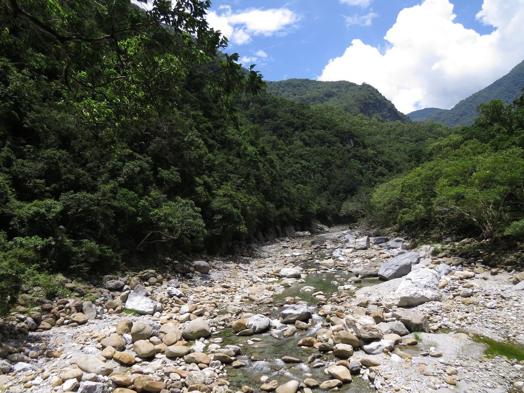
Shakadang Trail was first built during Japanese rule to facilitate the construction of Liwu power Plant. The path going along the Shakadangxi (river) was 1 m wide and 4.5 km long. Its original name was “Shenmigu Trail”; in 2001, it was renamed Shakadang. In the old times, Shakadangxi Valley used to be the residence of the Taroko tribe. All the signs are bilingual (Chinese and Taroko language). The trail features both ecological and humanistic landscapes.
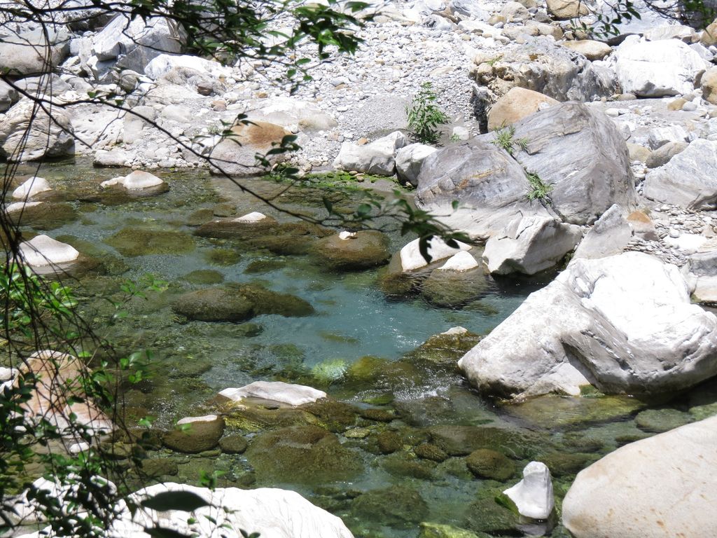
Previously, visitors couldn’t go further than Wujianwu by walking. After renovation, the trail spans from the entrance to the end point at “Sanjianwu,” a total of 4.1 km. The round trip takes 4–6 hours. Stakataka, the name for white rocks, were found all over the riverbed of the Shakadangxi (river), mostly marble and gneiss. The river decorated by the green and white rocks and the stonewall path are the most attractive feature of the trail.
Wujianwu, formerly called “Swiji,” is 1.5 km away from the trail entrance. “Swiji” means the banyan trees with large leaves. There were five residences on the original site of the checkpoint post, that’s why the place was named “Wujianwu.” At this location, some residents sell farm produce and agricultural specialties. At the end of the trail were three Taroko residences in the old times, so the place was given the name “Sanjianwu.” However, the Taroko people call it “Brayaw,” which means “night-scented lily.” From the name, people can imagine the scene of night-scented lily growing everywhere at the site.

Versatile Ecology with Species Abundance
Shakadang Trail is rich in ecological life. Major plant species are banyans, nettle family, lauraceae family and ferns. Squirrels, Formosan rock monkeys, and birds, such as alcippe morrisonia are visible in the trees. Butterflies found here are Graphium Sarpedon, Double-branded Black Crow (Brush-footed butterflies), and Kallima inachus. This is an excellent place to observe nature.
Landscapes including the Shakadangxi (river) appearing to be shades of blue and green, blue sky, natural stone walls make Shakadang Trail an experience of natural magnificence. Meanwhile, visitors can explore the traces of lifestyle in the aboriginal Taroko tribe. This is a must-go trail whenever visiting the Taroko National Park.
Transportation
●By public transportation
1. Hualien Bus (Taroko Line) – Get off at Taroko Archway.
2. Taiwan Tourist Shuttle (Taroko Line) – Bus 1133A – Get off at Taroko Stop.
Address: The Taroko National Park, Fushi Village, Xiulin Township, Hualien County
https://tour-hualien.hl.gov.tw/topic/hike/224